Coastal Hazards and Spring-Like Warmth: San Francisco’s Monday Weather Outlook
A Notable Shift Toward Warmer Skies
San Francisco kicks off the first Monday of February 2026 with weather that feels more like early spring than mid-winter. A strong ridge of high pressure has anchored itself over the California coast, resulting in a “notable warm-up” according to the National Weather Service. While much of the eastern United States is grappling with freezing conditions, the Bay Area is enjoying temperatures approximately 10 degrees above the seasonal norm. However, residents and visitors should not let the mild air lead to a lapse in safety, as specific coastal hazards are in play today.
Morning Forecast: Coastal Alerts and Cool Starts
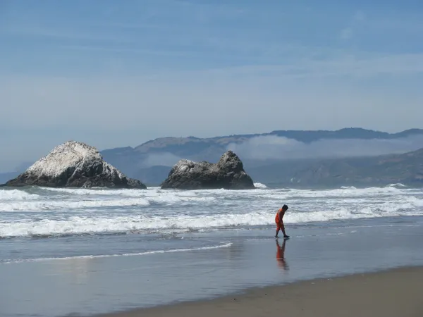
The morning hours will begin with temperatures hovering between 51°F and 53°F under partly cloudy skies. The primary concern for the early part of Monday is a Beach Hazards Statement issued by the National Weather Service, which remains in effect until 9:00 AM. Meteorologists have warned of dangerous conditions along the Pacific Coast, including:
- Large breaking waves ranging from 14 to 19 feet.
- Increased risk of sneaker waves that can catch beachgoers off guard.
- Strong rip currents affecting the shoreline from the North Bay down to Monterey County.
Officials urge the public to stay off jetties and rocks and to never turn their back on the ocean during this window of increased surf activity.
Afternoon Conditions: Mild and Sunny Intervals
As the marine layer diminishes and the coastal hazard advisory expires, the afternoon will see temperatures peak at a comfortable 64°F. The Mission District and other warmer neighborhoods may even see slightly higher mercury readings. Winds will remain light, primarily coming from the north at around 5 mph, making for a pleasant day for outdoor activities away from the immediate shoreline. The chance of precipitation is nearly non-existent, sitting at a mere 5%, ensuring that umbrellas can stay at home for the duration of the day.
Evening and Nighttime Outlook
Following sunset at approximately 5:34 PM, the air will begin to cool rapidly. Evening temperatures are expected to dip back into the upper 40s to low 50s, reaching a nightly low of approximately 47°F. Humidity levels, which start the day at a high of 81%, will settle into a more comfortable 64% by the evening. The sky will remain partly cloudy to clear, providing a crisp end to the day. Looking ahead, this warm and dry pattern is expected to persist through the first half of the week, with even warmer temperatures on the horizon for Tuesday and Wednesday.