Slick Streets and Gray Peaks: A Rainy Wednesday Sweeps Through the City
Wet Morning Commutes and Steady Downpours
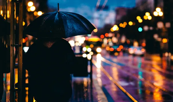
San Franciscans woke up to a drumbeat of rain on Wednesday, February 11, 2026, as a steady winter storm system moved through the Bay Area. The morning commute was particularly challenging, with heavy mist and consistent rain coating the hills and highways. Temperatures started in the mid-50s, but the high humidity and damp air made it feel significantly cooler for those navigating the city’s transit hubs or walking the dog through Golden Gate Park.
The National Weather Service noted that while a high-wind advisory for the broader region technically expired at 4:00 AM today, the early morning hours still experienced lingering gusts from the south. Commuters were advised to watch for minor debris on the roads and localized ponding in low-lying areas, especially near the Embarcadero and the Mission District.
Afternoon Showers and Persistent Cloud Cover
As the clock ticks toward the midday hours, the steady rainfall is expected to transition into scattered showers. While the intensity of the rain may fluctuate, the thick cloud cover remains stubborn, keeping the city in a gray, atmospheric shroud. The afternoon high is projected to reach approximately 58°F, offering a brief, mild reprieve from the morning chill. However, with a persistent 70% chance of precipitation, residents are encouraged to keep their umbrellas and rain gear close at hand through the commute home.
Winds are expected to remain active throughout the afternoon, blowing from the south-southeast at 10 to 20 mph. These breezes will keep the marine air moving across the peninsula, though the city’s signature fog will be largely replaced by more active storm clouds for the remainder of the day.
Today’s Weather at a Glance
- Morning: Steady rain with temperatures near 54°F; south winds gusting early before tapering.
- Afternoon: Transitioning to intermittent showers with a high of 58°F.
- Evening: Partly cloudy and drying out; temperatures cooling to a low of 51°F.
- Safety: Use caution on wet roads and be mindful of slippery sidewalks on steeper inclines.
Clearing the Way for a Cooler Evening
By tonight, the weather pattern is forecast to shift as the main front passes through to the east. The chance of rain drops significantly to about 25% after sunset, finally giving way to partly cloudy skies. For those heading out for the evening, expect temperatures to dip toward a low of 51°F. While the rain will largely taper off, the damp streets will remain slick, and the air will retain a crisp, winter bite. Looking ahead, the city may see a brief break on Thursday before the next weather system potentially moves into the region later this week.