Sun, Surf Hazards, and Haze: San Francisco’s Unseasonably Warm Thursday
Coastal Haze and Unusual Warmth: Thursday’s Forecast for the City
San Franciscans can expect a blend of spring-like temperatures and atmospheric alerts this Thursday, February 5, 2026. As a persistent ridge of high pressure remains anchored over the West Coast, the city is experiencing a significant winter warm spell, with temperatures climbing well above the seasonal norm. However, this calm weather comes with a few caveats: a regional air quality alert and a warning for those visiting the Pacific shoreline.
Morning: A Foggy and Cool Start
The day begins with a typical San Francisco chill, as morning temperatures hover in the low 50s. While skies are expected to be mostly clear initially, patchy fog may develop along the coast and near the Bay shoreline during the early commute. Visibility could be briefly reduced in low-lying areas, but any lingering mist should burn off quickly after sunrise, giving way to bright morning sunshine.
Afternoon: Peaking at 69 Degrees
By midday, the high-pressure system will push temperatures toward a projected high of 69°F, making it one of the warmest February days in recent years. While the morning will be predominantly sunny, thin clouds are expected to drift in during the afternoon hours. Winds will remain exceptionally light, clocking in at around 5 mph from the north-northeast. This lack of a strong sea breeze is what is contributing to the warmer-than-average readings throughout the interior of the city and along the Embarcadero.
Evening and Overnight: Cooling Down
As the sun sets, the mercury will drop steadily, returning to an overnight low of approximately 51°F. The evening will see increased cloud cover, though no measurable precipitation is expected. The humidity will rise to about 77% overnight, which may lead to the return of patchy fog in the early hours of Friday morning.
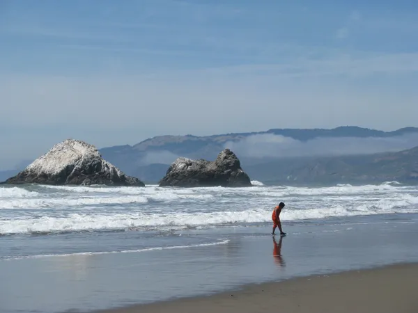
Critical Alerts: Spare the Air and High Surf
- Spare the Air Alert: The Bay Area Air Quality Management District has issued a Spare the Air alert for today. A temperature inversion is currently trapping pollutants and haze near the ground. Wood burning is strictly prohibited, and residents with respiratory issues are advised to limit outdoor activity.
- Beach Hazards: The National Weather Service has issued a Beach Hazards Statement effective today. While a larger High Surf Advisory begins Friday, today carries an increased risk of sneaker waves and strong rip currents. Coastal visitors are urged to stay off jetties and never turn their back on the ocean.
- Rain Chance: Minimal. There is a nominal 0% to 10% chance of a light sprinkle late tonight, but most of the region will remain dry.