Twenty Days of Dry: San Francisco Squeezes Out One More Seasonable Monday Before Showers Return
The Dry Spell Holds: A Crisp and Seasonable Monday for the City
San Francisco residents can expect a calm and temperate start to the final week of January. As of Monday, January 26, 2026, the city is marking its 20th consecutive day without measurable rainfall—a notable dry streak for the peak of the winter season. While changes are on the horizon for later in the week, today offers a stable and pleasant window for outdoor activities across the Peninsula and the greater Bay Area.
Morning: Mist and Mild Temperatures
The morning hours will begin with characteristic coastal layering. While some patchy fog may linger near the Bay Bridge and the western edges of the city, skies are expected to transition to a mix of sun and clouds by mid-morning. Temperatures will start in the high 40s, so a light jacket is highly recommended for the early commute. Humidity levels remain relatively high, hovering around 80%, giving the air a crisp, damp feel despite the lack of active precipitation. For those in the North Bay, low clouds will be more prevalent, but San Francisco proper should see clearing as the morning progresses.
Afternoon: Upper 50s and Gentle Breezes
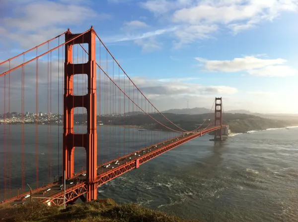
Weather conditions will reach their peak in the mid-afternoon, with high temperatures settling into a seasonable 57°F to 58°F. The clouds will remain scattered, allowing for significant periods of sunshine throughout the day. Wind speeds are forecast to be light and manageable, primarily coming out of the south-southwest at a gentle 5 to 10 mph. This makes for an ideal afternoon for a walk along the Embarcadero or a visit to Golden Gate Park, as the biting winter winds and heavy gusts seen earlier in the month have largely subsided. Visibility remains high at 10 miles or greater, ensuring clear views of the skyline and the Pacific.
Evening: Increasing Clouds and a Hint of Moisture
As the sun sets, the cloud cover is expected to thicken significantly across the city. Evening temperatures will gradually dip back into the upper 40s to low 50s. While the daytime remains entirely dry, meteorologists indicate a slight shift in the atmosphere late tonight. A 20% chance of light drizzle or a stray shower may emerge after midnight, signaling the potential end of the region's three-week dry spell. However, any precipitation tonight is expected to be effectively meaningless in terms of accumulation.
Summary of Today's Conditions
- High Temperature: 58°F (14°C)
- Low Temperature: 48°F (9°C)
- Wind: South-southwest at 5-10 mph; no high-speed gusts expected.
- Precipitation: 0% chance during the day; 20% chance overnight.
- Warnings: There are no active wind, rain, or coastal flood warnings currently in effect for the San Francisco area today.
While the current conditions are stable and dry, residents should prepare for a more active weather pattern starting Tuesday afternoon and evening. For today, the city remains under a canopy of mild, partly cloudy skies, perfect for squeezing in one last day of outdoor plans before the umbrellas are likely needed later this week.